
The first principle of planning a Permaculture system is to observe and interact with the environment in which your eventual plan will unfold. For me this meant waiting an entire year before implementing my design plan. It’s all too common for people to pick their location before ever really understanding how light and water flow across the landscape. Then once on site, pure excitement overwhelms the mind. Folks jump into building, planting and establishing zones without the knowledge that first year provides. This often leads to more time undoing what was previously done, or less than ideal establishments. As a very excitable and impatient person, this was very hard for me. But if I can do it, so can you. I can’t recommend it enough.
During this time observing, I watched how the light fell across the land throughout the year. We live downslope with a slight grade of about three percent. The property faces south with full sun exposure. Even in the winter months, the land gets light from sun up to sun down.
Watching what parts of the land receive first and last light effects the placement of items such as beehives, garden beds, the overstory, other trees that might cast shadows throughout the day, and the various zones throughout the system.
I also observed how the water flowed across the land during this first year on location. Because I live on a slightly slopping land, there is very little standing water. I also observed that around the end of November, a natural spring begins to flow at the very top of the property. Understanding where the source of water originated I was able to design a water catchment system that includes a pond and a series of swales that trap, sink and slow the flow of water as it travels from the top N.E. corner of the property to the bottom S.W. corner.
These two primary ingredients in the growing system helped shape all of the other plans in my design. They helped to determine where the raised beds will go, where the irrigation lines will be placed, how the grazing rotations will be scheduled, where greenhouses and outbuildings will be placed, and how the long-term plan will unfold over the course of time.
Google Maps provides another great way to observe the land. If you visit the site of your own property frequently enough, you will notice that Google re-images the area annually (they do in my area anyway). The three images below provide insights into what areas of the land retain more water than others, what areas dry out the fastest, and how the system takes shape over the years.
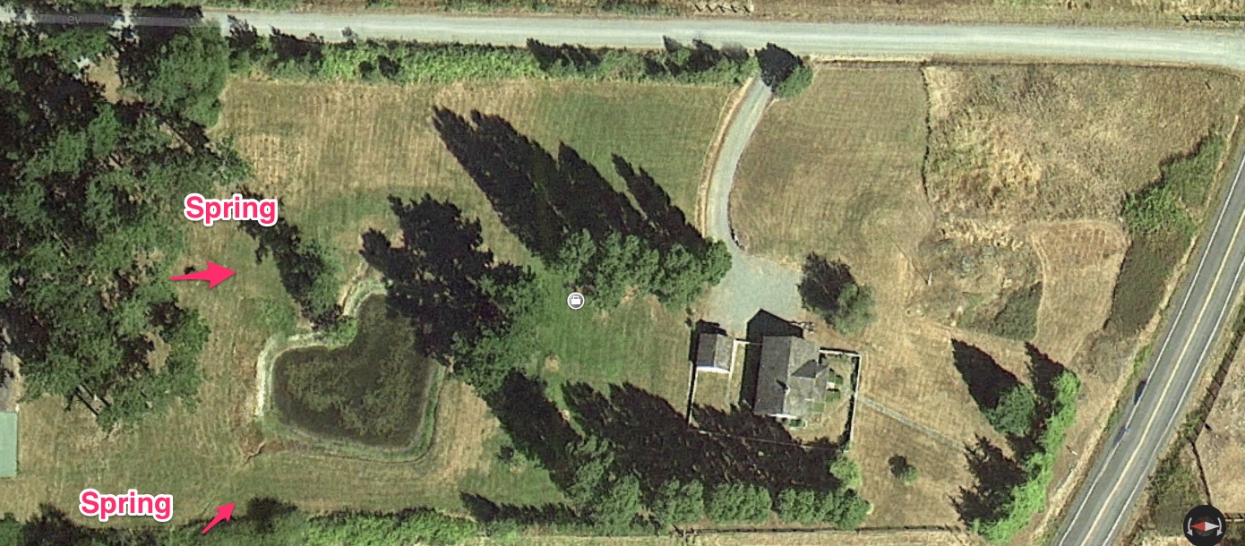
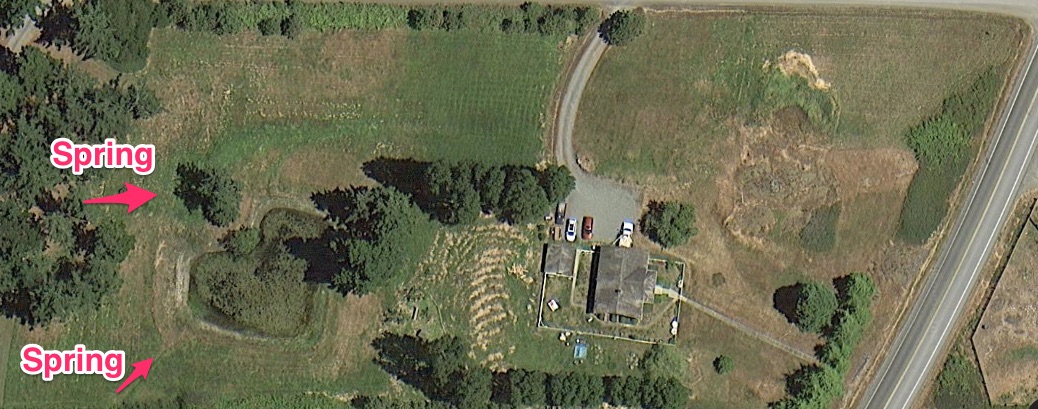
In this image you can see how very little work has been done in the full year of observation and how the land remains pretty much as dry as the year before. If you click on the image to enlarge it, you might also notice how congested the pond is and how it is not retaining water.
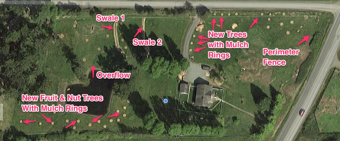
A full two years since living with this land, you can see many things have taken shape. You will notice the formation of two swales in the system, and many mulch rings containing new trees planted in the spring of 2015. You can also see that the grass is much greener. This is due to Google imaging the location a bit earlier in the season.
Hi,
Do you still offer the design service? I am very interested. Please email me with information.
Kind regards,
Veeru